In wind and rain: Glacier research under extreme conditions

It’s well known that the glaciers are melting. But how do researchers prove that is the case? Franziska Temme is a research associate at the Institute of Geography at Friedrich-Alexander-Universität Erlangen-Nürnberg (FAU) and has taken part in three field trips to the Cordillera Darwin ice field in South America. In a study, she has now determined the mass balance of the glaciers there using model simulations. She also used data that she collected herself on site.
Glacier research at the Cordillera Darwin ice field
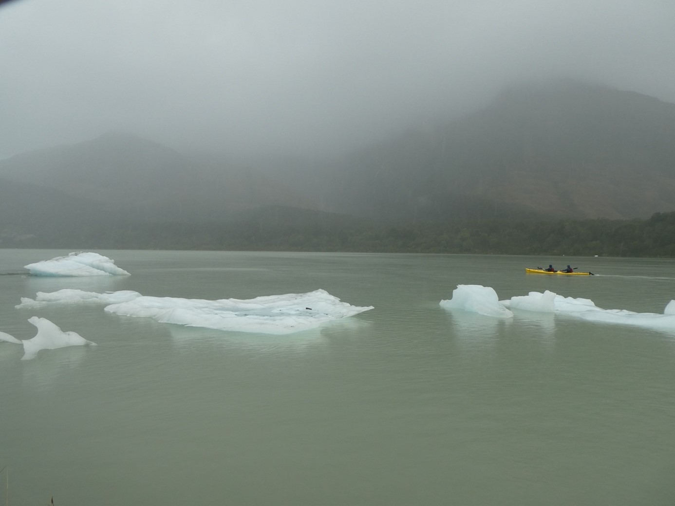
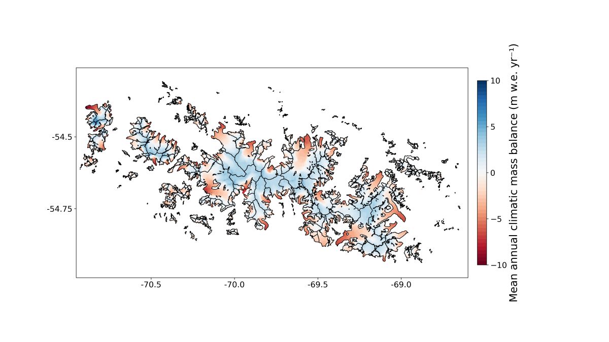
The Cordillera Darwin ice field is located in Tierra del Fuego at the southernmost point of South America. It comprises an ice mass that is almost twice the size of that of the European Alps. Its extremely remote location and inhospitable climate conditions mean that little research has been carried out on the ice field to date. In their new study “Climate’s firm grip on glacier ablation in the Cordillera Darwin Icefield, Tierra del Fuego“, Franziska Temme and her colleagues Johannes Fürst and Christian Sommer have determined the ice mass of the glaciers of the entire Cordillera Darwin ice field for the first time by using model simulations. A glacier such as this one can gain mass on its surface, for example, through snowfall, or lose mass through melting. Some glaciers are also losing mass on the glacier fronts. Many of the glaciers in Cordillera Darwin end in lakes or fjords where icebergs can break off.
Inaccessible terrain
From Punta Arenas, which is the southernmost city in Chile, it takes almost 6 hours by boat to reach the Cordillera Darwin ice field. It is not only the researchers who have to reach the ice field, but also their equipment – for Franziska Temme’s excursions, no fewer than three kayaks. The researchers often receive support when they arrive and leave from the Chilean Navy, which regularly patrols the area.
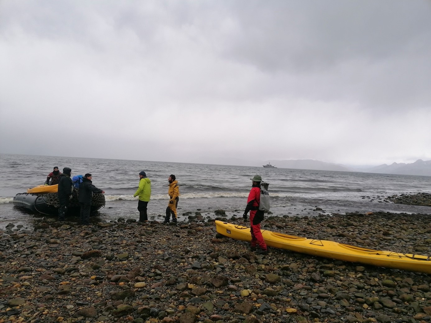
The navy often provides even more support, explains Franziska Temme. For example, when the researchers forgot the box that contained all their breakfast rations for a field trip on board the navy ship. “We would really have struggled to make the food we had stretch for ten days,” she explains. “Luckily, another navy vessel was traveling back on the same route and brought us the box a few days later.”
Everything is wet
In addition to the remote location, the weather is a major problem during research. “The weather is almost always bad there,” explains Franziska Temme. Cordillera Darwin is known for strong winds and high levels of precipitation. “We were usually very lucky with the weather though,” she remembers. Being lucky in this case means around two days of sunshine during a ten-day field trip.
In contrast to many other glacial regions, cold temperatures are not the main problem when working at the Cordillera Darwin ice field, but rather the high humidity. “Everything gets wet,” summarizes Franziska Temme. She explains: “The longest phase of rainfall measured since 2015 at the Schiaparelli glacier was three months. It rained non-stop every day for three months.” This can be a problem for the researchers’ sensitive measuring devices. It also makes everyday tasks more difficult: “A notebook is instantly soaked through. You have to use waterproof paper if you want to make notes.”
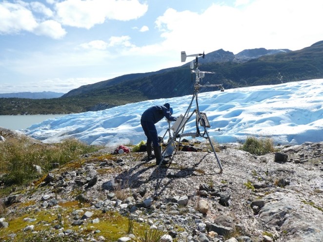
Measuring air temperature, melting and ice thickness
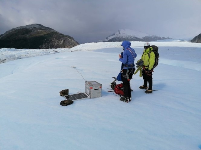
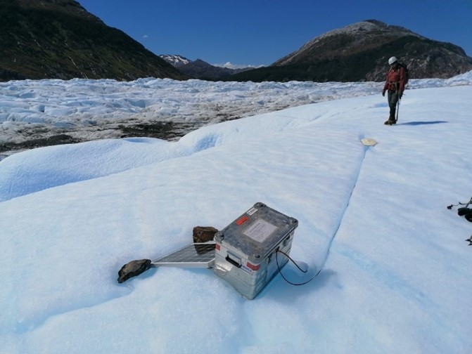
There is a weather station located directly next to the Schiaparelli Glacier that has been operated by Humboldt-Universität Berlin since 2015. It measures air temperature, humidity, incoming radiation, wind speed and the direction and amount of rainfall. These data are extremely important in order to understand the melting processes on the glacier surface and to illustrate them in a model.
One important measurement is one that is known as ablation measurement. The principle is simple: The researchers drill a hole in the ice and insert a pole that is eight to ten meters long. A year later, they measure how much of the surface of the glacier has melted during that time. Melting rates of up to eight meters per year are common on the glacier tongues of the Cordillera Darwin ice field.
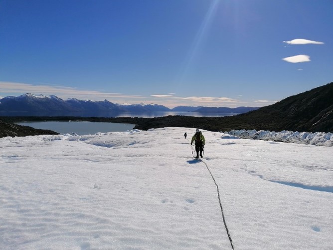
The thickness of the ice is a very important factor for determining the future development of the glaciers. It is largely unknown in the Cordillera Darwin ice field. The thickness of the ice was measured in the Schiaparelli Glacier a few years ago and Franziska Temme and her colleagues measured it again a few years later in another area of the glacier. A radar antenna is used that sends a signal into the ice. The signal is reflected on the glacier bed and received by the measuring device on the surface. This enables the thickness of the ice to be determined. “The ice is up to 300 meters thick in this area,” she says.
Tracking the movement of glaciers using GPS measurements
Another important aspect when recording the development of glaciers is the movement of a glacier. By using a GPS antenna, the researchers were able to precisely track how fast the glacier was moving in which direction. When installing a GPS point near the glacier front of the Schiaparelli Glacier, the researchers had to weigh down the solar panel with two large stones to prevent it from flying away in the strong winds typical of the area.
But unusually good weather can also be a problem for research. For example, a cable melted into the ice after five days and an unusual heatwave. “Luckily it was also quite warm on that day and the cable was not frozen stuck,” explains Franziska Temme.
“I was surprised to see how great the loss was.”
Franziska Temme bundled the information she gathered during her field trips with large amounts of data from other researchers to generate her model simulations. These simulations show how the Cordillera Darwin ice field has changed between 2000 and 2023. There’s no denying it: The glaciers are melting, and this is especially due to the high increases in temperature in the region. What was unexpected for the researchers was how high the mass loss of the glaciers really is and how much it has increased during the last 23 years.
In addition, it is also clear that the wind speed has also increased, presumably the result of climate change.
Further information:
Franziska Temme
Institute of Geography
franziska.temme@fau.de